Tuesday, October 23, 2007

19. Blueberries & Brotherly Love

(27 June)
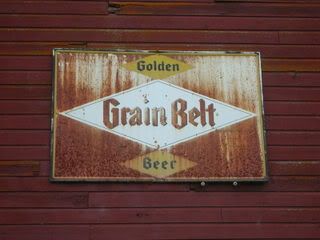
On Wednesday, neither of us felt like canoeing, although we had discussed a Vermilion River adventure. Sometime the day before, while passing through Buyck, we had stopped at the river to check out the water access. There, across the road from the VRT (Vermilion River Tavern), was a shabby golf course, on which stood an old barn where they kept the golf carts. On its north side, facing the river, hung an ancient Grain Belt sign, at least as old as the sacred bottlecap sign on the Mississippi in downtown Minneapolis. This sign was streaked with a gorgeous patina of rust.


Today, our first order of business was to call my mom to let her know we were definitely coming home the next day. My dad didn't want to drive to Orr again, because we had made the twenty mile drive every day we had been there. We got on the road and watched our phones for a signal. Funny enough, we got absolutely nothing until we reached the city limits of Orr. My dad made the call while I heeded nature's call inside the gas station.

We then parked in front of the on/off-sale liquor store/tavern to take care our second order of business: buying beer. I think we had about ten cans left for our last night, but when my dad had opened the cooler that morning, he became worried.

Since I had forgotten my ID, I stayed in the car, just to make it easier. My dad entered the building, and soon afterward, a man stepped out of a large black pickup next to me. He had a big, blond, Hogan mustache, and a long, greasy, curly mullet. He was quite a specimen of man, and he, too, entered the tavern.

While they were inside, I checked my messages from the past few days. There was a message from my friend Sho, who said that he and my other Rambo-watching buds had been playing music together, and were trying to book a show. Their name: Rambro!

My dad came out of the shop empty-handed. The other man also came out, they exchanged words, and my dad got in the car. He shook his head in disbelief. "You won't believe what just happened," he said. "So their computer was down. And the girl working was really stupid. I had my twelve-pack of Miller High Life up at the counter, and she said we can't make the exchange!"

"You couldn't just just give her the cash, and she'd ring it up later?" I asked.

"I guess not!" He sighed loudly. "So I turned around and was putting the beer back in the cooler, when that guy walked in. He must have thought my card didn't go through or something. And immediately, he said, 'Bring that back up here. I'll pay for it.'"

"Whoa!" I exclaimed.

"And at first, I brought it back. I thought maybe he was a local, and he knew how to handle these things. But when he found out the situation, even he couldn't do anything."

My dad was visibly touched by the man's kindness. The guy hadn't hesitated one instant, probably because he'd been on the opposite side of that situation before. He would not let my dad go without beer. What a man!

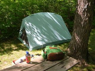
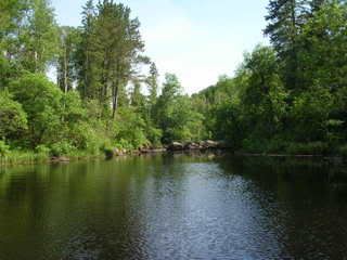
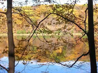
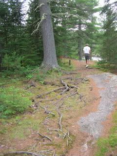
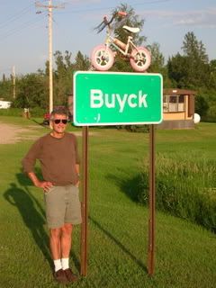
After getting our beer at the Sportsman's Last Chance in Buyck, we wanted to take a long hike, and decided to start in our campground at the Echo Lake Trail. It headed east from the main loop, beginning right next to the self-registration station.

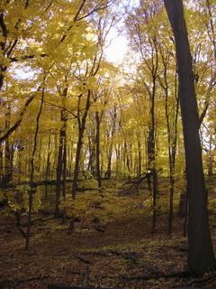
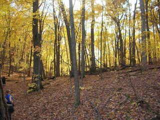
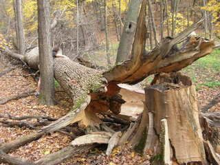
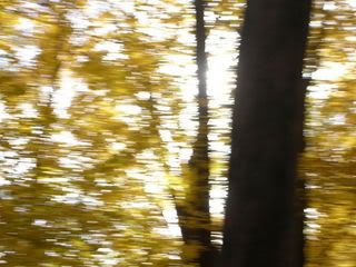
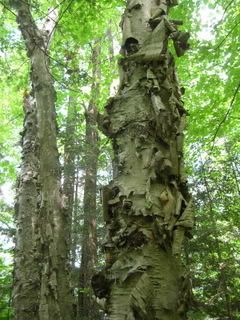
We walked a ways through the woods, and the trail opened up onto a rocky outcropping with jack pines and a few blueberry plants with ripe berries. We enjoyed some while we paused to enjoy the spot. Continuing on, the trail led through the woods and onto more outcroppings. On these, the trail, worn into the soil in the woods, was invisible, but was marked by cairns someone had piled.

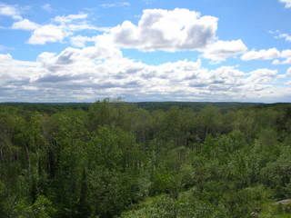
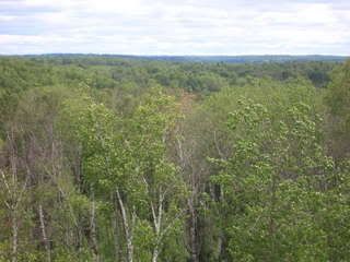
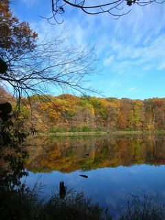
It was another beautiful, sunny day. Eventually, we emerged from the woods a final time, onto a huge expanse of rock and jack pines, from which a murder of crows took off. The rock face overlooked an immense valley of birch trees. And all around us grew ripe blueberries! I told my dad I wanted to go back to camp to get a tupperware to fill up, since blueberries are like seven dollars a pound in the store, and here they were, freely growing. He offered his quart-sized nalgene bottle to fill up, and this we began doing with determination.

A big handful contained about fifty of these smallish berries. We moved forward as we harvested, leaving countless missed berries, plus the underripe ones on each plant. Someone could do this again in a few days.

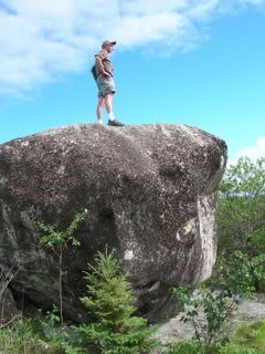
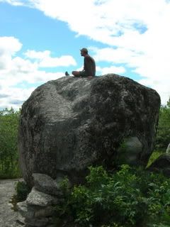
As we neared the top of a hill, we saw a giant boulder, twelve feet wide, just sitting at the summit like someone had placed it there.


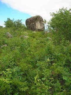
It was the highest point in the area. A cairn-builder had erected steps up to the climbable edges of the boulder, and I climbed up. Standing on top, I could see over the entire valley. The view was incredible.

Views from the boulder:


Then my dad took a turn up top.


When the bottle was filled with berries, I stowed it in my backpack. We could find no trail continuing on from the hillside, so we made our way back to camp.

That night we ate spaghetti dinner. As he had every other night that week, my dad took one last beer into the tent with him. There he read short stories by flashlight, and I would invariably find him asleep with his eyeglasses on his chest.

(28 June)
In the morning, we ate breakfast, struck camp, and said goodbye to Echo Lake.

A few hours down the road, in Hibbing, we went to SuperOne Foods again to get more of that ARCO coffee. While I waited for my dad to exit the bathroom, I overheard a checkout girl say she was going camping that weekend, at Echo Lake! Was this a crazy coincidence, or was it really that popular? It is an exquisite place to camp.

We got to the coffee aisle, and the entire ARCO display was gone! Not a trace remained. It must have been so cheap because they were discontinuing it. ARCO's new packaging had its own spot, and was regular coffee price. Shucks! We bought some snacks and hit the road.

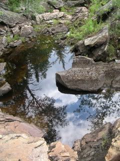
Later, I directed us to the Aitkin County park with the aquifer. My dad was really into these side adventures, and said that he learns so much when we are together. The same is true for me. This had been the best father-son camping trip I'd ever experienced. It was different than any other because I was grown up. My dad had taught me most of what I know about camping, but on this trip, because he was really on vacation from his grueling academic duties, I naturally assumed leadership much of the time. The roles I knew from childhood were reversed. Maybe he was testing me.

Monday, October 22, 2007

18. Real American Heroes

(26 June, continued)

Back at Echo Lake we once again embarked on a paddling adventure. Our goal was to find where Pickett Creek entered the lake, and to see if it was traversable. My dad had passed it on his jog, where it flowed out of a bog that was a designated grouse and woodcock management area.

The wind blew from the west, at our backs, as we paddled east from the dock, I at the bow. We knew the trip back would be brutal. Echo Lake was a lot bigger than either of us had thought. It wasn't too wide, but looked to be at least three miles long, east to west.

After paddling a short while, and after a few rests where my dad cast in his line, we found a little bay, hatched on the edges with the vertical green lines of reed beds. The bay was surrounded by beautiful woods, birch to the east, and pines to the west. A huge white pine stood alone on a small peninsula at the mouth of the bay, guarding its treasures. Sheltered here from the wind, the flies found us, and I soon incited our return to choppy water.

We paddled leisurely south, toward the inside of the bay, into which the creek seemed to be flowing. I scouted ahead for rocks just below the water's surface. Soon we could see Pickett Creek, gurgling over rapids and a little waterfall into Echo Lake. It was picturesque.


The west side of the bay was bordered by rows of straight, slender birch. We watched as a huge heron flew up and behind the outermost row of birch, and then flew slowly along the shoreline, just behind the treetops, with the sun shining at us through the yellow-green leaves.

Magnificent.

We could not go in any further due to rocks. I asked my dad if he was going to fish, and he said that we had better head back, because it was going to take a long time. We made our way back to the main body of Echo Lake, the water choppy like the sea, as a steady gale ripped across its entire east-west length. We dug in and paddled our boat straight into the stream of wind and water. My left shoulder was too sore for this. I asked my dad if I could switch sides, and he said I could paddle on any side I wanted. So I switched, and comfortably paddled on the starboard side the whole way back.

As we battled the elements in our vessel of ancient design and modern materials, I saw now how quickly we had gotten down here, pushed by the wind as we had been. Now we fought against it, the wind and the evening sun in our faces. The boat rocked with the waves. Progress was steady and slow, the wind unrelenting. I gritted my teeth, set my resolve, and locked my gaze at a point of land half a mile ahead, which blocked our destination from view. Again, anger helped pump adrenaline through my straining muscles. I was Rambo. My eyes were set with grim determination beneath my furrowed brow, my jaw in a scowl.

"This is for you guys," I repeated in my mind. This was 'Nam. It was up to us to set the POWs free. My suffering at the helm of this canoe was nothing compared to the tortures inflicted on my comrades. "This is for you guys."

We slowly approached a couple leisurely fishing in a drifting motorboat. As we struggled past, their gazes followed us, and they surely thought we were nuts.

I then used a cycling technique with my paddling, to make sure I didn't burn out before we achieved victory. I noticed that my natural paddling technique was similar to my peddling technique, most likely due to my elongated frame: I ride a big gear. I paddle with long, deep strokes. This is a recipe for power, but also for early burnout. So I increased my paddling cadence, instead using shorter, more shallow strokes, but more of them, faster. It seemed to do the trick. "This is for you guys." I paddled in a frenzy.

It took probably three times longer for us to return than it had going out. We beached, strapped the canoe onto the car, and had a Red Dog down by the boat launch, before returning to camp. For dinner, we ate refried beans, boiled potatoes, and yams.

At sunset, my dad stood next to the car with its canoe helmet, silhouetted against the chrome-colored lake. That sixteen-foot Alumacraft canoe had been in the Stoltz family since 1961, but it was the second. The preceeding canoe had been left in Brownie Lake overnight by my young aunt Maxine, and it had been stolen. She told their folks that she had only left it for a few minutes. Her older brother, my dad, kept her secret.

My mind reeled to imagine all the bodies of water our canoe had traversed over the years. The dull scratches of countless logs, rocks, and beaches covered its hull, as did all the old registration stickers. With a beer in my hand, I stood in awe and reverence. This canoe had never let us down.

The aluminum canoe is such a potent symbol of Europeans in America. The shape is purely Native American in design, adopted by the French-Canadian voyageurs, and crafted, at that time, out of the traditional materials: birchbark, roots, and gum. Aluminum canoes are made from metal mined from the earth by massive, destructive industry. The newer fiberglass ones are created with sophisticated chemistry and engineering, melting sand into glass, and weaving it into powerful strands. But the design remains as it has for thousands of years. Elegant and simple. A silhouette of the past.

Later, my dad and I walked out to the road where the fireflies wandered the night air. "You know what I'm thankful for," he said with earnest, "is that we don't have Tyrannosaurus rex running around. I'm scared enough of bears. But to have those bastards running around, eating people." He shook his head bitterly. "They don't care. They don't care about what you're doing."

Anachronistic Photos, Catalogued

The publishers can only afford one signature of color photos; you know how it is.

The following photos were taken on Saturday, 20 October, 2007, in Wood-Rill Scientific & Natural Area in Orono. So, chronologically, they don't go with the story. However, that old-growth maple forest is gorgeous right now, and you should get out there. Read about it in one of my previous entries, which gives bike directions at the end. In a car, from Minneapolis, take 394 west, which turns into Hwy 12, and then take a right on Old Long Lake Road. Careful, it comes up quick after a blind turn. Then go about a quarter mile, and you'll see the sign for the parking lot, which will be on the right.


Taken by Ellie Ramson.


This tiny little guy had a bright orange belly!


Don't worry; he's just sleeping. For eternity.


Wicked blowdown. The harder outer bark broke in a perfect zigzag. That's my sister.

Thursday, October 18, 2007

17. Riders on the Storm

(26 June)
On Tuesday, the wind continued to blow, the sky was grey, and my shoulders were sore from paddling. Regardless, after breakfast, my dad and I launched the canoe into Echo Lake. We had only paddled about 100 feet when we felt raindrops and saw lightning in the west. A motorboat was heading back to the dock we had just left. I turned to my dad and said, "Are we stupid...?"

He let out a small laugh and said, "Maybe so," and we returned sheepishly to the dock. In the increasingly heavy rain, we chained and locked the canoe upside-down to a tree, and then got back in the car. We decided to drive up to Crane Lake. My dad told me that it was once a really popular resort area, and his parents had vacationed there as newlyweds.

From this, and my experiences the past week, it seemed apparent that the North Woods, in its pristine beauty, had once been a major gem of national tourism. Its current state, with the faded handcrafted signs, and their masterly aesthetics that stand out in a world of ever more mindless and soulless computer-generated design, added a whole new patina of beauty to my eyes.

As we drove through the rain, I endeavored to choose some music. "I wish we had the Doors' song 'Riders on the Storm'," I said.

"Look in the glove compartment."

There it was, The Doors, backed with L.A. Woman. Sweet. I put the tape in the deck, and whatta-you-know, it was nearly queued to that song already. There could not have been a more perfect song for us two men in that place at that time. The whisper tracks form a mist around Jim's words. Afterwards, the tape continued onto the Doors' first album, which fit with the weather as well. We passed a giant statue of a voyageur.

Crane Lake sits on the border of Voyageurs National Park. I never really think much about the fact that Minnesota has a National Park, and I have yet to explore it. The township of Crane Lake is but a handful of cabin resorts, and in the midst of them, St. Louis County Road 24 abruptly ends. Beyond that lies only shabby dirt roads and gravel-surfaced private drives. We tried one road for about a minute before turning around. We slowed down at one point so I could take a photo of a dirt bike trailer with some killer graphics that read, "Hyper Viper Race Team."


We headed out of town the way we came, my dad pointing out the cabin-boats my grandparents had rented. That would sure be a nice vacation for a couple of newlyweds.

A couple miles south of Crane Lake, we saw a sign for Vermilion Falls, and we decided to check it out. Was it a town or a natural landform? It turned out to be a Superior National Forest recreation area. We parked in the empty lot, and exited the car into sunshine. My dad took his fishing gear, and I took my camera. The trail was rocky and beautifully uneven, with roots of big white pines snaking over the rocks.


We could hear a waterfall, and soon came upon one zigzagging through a jagged gorge of dark granite. It was like a miniature Jay Cooke State Park. Between the trail and the falls were sublime crevices and pools surrounded by little pines growing from the rocks.


My dad began to fish, and I explored the small but densely beautiful site. I told him I was going back to the car to grab my drawing tablet, and he bade me fetch his eyeglasses. As I searched for them, a car pulled in, and a family set out to hike. I brought my dad his glasses, and then I found a hidden spot in the rocks, where I sat in the sunshine shooting photographs.


The beauty surrounding me kept me shooting for quite a while. I was excited to sketch. I found a couple of twigs to use as pens, and I placed them in a crevice near where I was sitting. I decided I could shoot some video of the falls at the same time, so I got up and began walking back to get my camcorder and tripod. I took my backpack with me. As I approached the parking lot, I saw my dad passing by up ahead. I called out to him, and he stopped.

When I neared, he told me he was done fishing and wanted to return to Echo Lake. I told him my plans, which had hinged on the assumption that he'd be fishing a while. Since he wasn't, I immediately said it was fine, I'd done enough, and we could go. I only wanted to sit and draw a while if he was occupied too. So we took off.

Moments after passing the voyageur statue again, my dad stopped the car, and turned around to take a closer look.


The voyageur had a big, creepy grin, and the text below him read (sic):
This memorial was erected by the Crane Lake Commercial Club to commemorate the FRENCH CANADIAN VOYAGEURS who explored and opened this country beginning in the late 1600's.

Thousands of these dauntless men rowed their birch bark canoes through these waterways in the quest of furs and the Northwest Passage. One of their forts was at the mouth of the Vermillion River in Crane Lake.

The gay garb of these happy courageous men is typified by our memorial as he stands here proudly surveying the lands and waterways he once roamed.

HOME OF THE VOYAGEUR

"The gay garb of these happy courageous men!"

The other interpretive signs were just as poorly written. One began by stating that the landforms of the area "predate" the Native Americans. Yeesh. Really?

...to be continued...

Thursday, October 11, 2007

A Guide to Minnesota's Scientific & Natural Areas

Book Review

A Guide to Minnesota's Scientific and Natural Areas, by the Minnesota Dept. of Natural Resources, 1999.

I found this book invaluable on my explorations of SNAs this summer. It is not only a guidebook, but an advanced course in Minnesota's biomes and geology. The book is divided into three sections, corresponding with the three major biomes, and each of the many ecological subsections are described in academic detail. I would recommend it to both novice and master naturalists. Whether your focus in exploring SNAs is on flora, fauna, geology, or ecosystems in general, this book has the information you need. Reading it will also give you an understanding of the state's geological history. What WAS here, and what is here now.

The book gives directions to all the SNAs, using the nearest towns as reference points, and does so using mileage. For instance, "go one mile down this road, two miles down that road," etc. I drove past sites many times because of this, since a mile is nothing in a car going down the highway after driving hundreds. I suspect that some of these distances refer to the border of the site, rather than to access points and parking areas. Therein lies a minor problem, which could be updated in a revised edition.

One disappointing experience with this came when exploring the Gneiss Outcrops SNA. It is a fairly large prairie site with no trails. I had read Worlds Within a World: Reflections on Minnesota Scientific and Natural Area Preserves by Paul Gruchow, who described an amazing lake in this SNA. After hours of exploring, I never found it. Nevertheless, Gneiss Outcrops is an enchanting place, and well worthwhile. The Guide needs better directions for within sites, especially when there are no trails. Those included in the current edition can be vague.

Part of the adventure in exploring these areas is that entrances and trails may not exist. If you wear boots, and can identify poison ivy, you'll be fine.

As mentioned in my previous post, the map of Pelican Lake was horribly vague. It mentions that Big Island is only accessible by boat, but when actually traversing the water, it would be nice to have an accurate map showing all the islands. There were dozens, and it only shows two!

The Guide is bound with a plastic spiral, a la Kinko's, which seems cheap, but is extremely handy for field use. The pages are thick cardstock. My biggest criticism is that the cover is made from the same stock (something durable and waterproof would be great), with this annoying extra "flap" that's connected to the back cover, and folds over the whole outside of the book. I attempted to fold it inside, and it ended up sticking out half an inch beyond all the other pages. I should have cut it off, knowing now that I'd never use that outer cover again. Design issues.

Included in the book is a seperate fold-out map of the state, showing all the SNAs, which fits in a pocket in the back. This was indespensible in planning my project, where I visited several SNAs on each trip, and had to chart which campgrounds were nearby.

All in all, the book is essential, but could be made much more useful with additional field research and an updated edition. Hey, if the DNR wants to pay me a couple years' salary, I'll do it!

Monday, October 8, 2007

16. Battle for Big Island

(Monday, 25 June)
We woke up, my dad jogged, he bathed in Echo Lake, we ate breakfast, and then we headed out for the critical adventure of our trip: canoeing to Big Island Scientific & Natural Area in Pelican Lake. According to my guidebook,
"Big Island has escaped significant disturbance by fire or humans for over 150 years. As a result, here one can see a collection of old-growth communities, including hardwood-conifer forest and aspen-birch forest, that seldom attain old-growth status... [Also,] at least 40 bird species are summer residents on the island."
Judging by the map, the island lay about two miles over water from the nearest boat launch.

We picked up ice and more coffee in Orr. The ice bag depicted a man in front of an igloo, apparently urinating ice cubes, grimacing, and thinking, "ICE..." Inside the gas station/grocery/video store was also an A&W restaurant, and I saw the girl behind the counter pouring root beer from a two-liter bottle. Don't they have kegs of that stuff?

Orr sits on a bay on the east side of Pelican Lake, which is about eight miles across. The closest boat launch to Big Island was on the west side of the lake, so we drove over there, past the Vince Shute wildlife sanctuary. This launch was really rustic, pretty much just a big rock going into the water. The sun shone bright overhead, and cumulus clouds raced across the sky. The temperature was in the nineties. A strong wind blew from the south, and the water looked really choppy. But we were men. We had a mission. And we were going for it.

We loaded up the canoe, my dad with his fishing gear, and I with my art supplies. I climbed into the bow, and my dad launched the vessel, past a family bobbing in a speedboat, who might have thought we were crazy for challenging the elements in a canoe. As we paddled into the wind, we found we were trucking along pretty swiftly. Canoeing into the wind is far easier than going perpendicular to it, and we maneuvered in this way, trying to stay sheltered within the lee of the islands.

My map had shown only two other little islands besides Big Island, but in reality there were at least a dozen, and we could not differentiate our destination from these until we had cleared several of them. A couple had cabins on them, and one little one was an SNA. Pelican Lake is aptly named, not because it's shaped like a pelican, but because it harbors squadrons of the huge birds. Big Island became apparent as we approached. It is about a mile wide, with a bay on the western side.

We drifted near the island's shore. I ate a sandwich while my dad cast a few lines into the clear, shallow bay. We traced the shore for a while, looking for a trailhead, but we saw none. We docked at a large rock face. My dad said he'd hike with me for a bit, and then he'd go fishing while I explored. It immediately became apparent that there was no trail here, and the thick brush made for more of an adventure than my dad was looking for, so he left me to continue on my own. It was 2:00 pm, and I said I'd meet him back here (at the southwest side) at 5:00. I turned around and headed into the bush.

I never did find any man-made trails. I made my way through the thick undergrowth by following game trails and paths cleared by massive blown-down old trees. I cut a path directly across the island, heading northeast. It was a pretty strenuous hike, constantly pushing through undergrowth and scouting out the path of least obstruction. I was constantly brushing spiderwebs off my sweaty skin. My light cotton long-sleeve and wide-brimmed leather hat helped quite a bit. I grabbed a cudgel to fend off wild beasts, and it also served to push aside branches and webs ahead of me.

Rocky outcroppings and blow-downs offered respite from the trail-blazing, and at these places I stopped to check my compass. Every time I did, I found my sense of direction intact. I had never hiked in such a forest before, one so thick, and with no trails. I really felt like I could have been the first human to tread there, and that was a sublime feeling. I knew the adventure would keep me occupied today, and that I would not be sitting and drawing.

As the book said, a tamarack swamp formed a waist-line across the island. I saw old-growth white pines, none quite as big as in the Lost Forty, but I saw the gnarliest old birch tree I'd ever seen. Its bark curled off in massive rolls all the way up.


An osprey became perturbed at my presence, and circled above me, over treetops at the edge of a clearing, squawking with annoyance, until I disappeared completely.

In an hour's time I reached the northeast side of the island. I found a shady grove of cedars on the bank, and I sat there on a log over the water, feeling the breeze for a while. I then headed back into the bush. I fancied seeing the southeast side of the island, so I started following the shore. This immediately proved difficult, so I turned inland, not straying too far from my previous path.

Big Island is scattered with little groves of mossy rocks and cedars, stands of hardwoods, huge aspen and birch, and tamarack in the lowlands. Most of the pines are on the western side, but are found throughout the island as well. The western side has the highest elevation. From there, a series of high, rocky outcroppings periodically step lower and lower as one travels eastward.

I found myself at the easternmost of these outcroppings, a southeast-facing rock face scattered with cedars and small, spindly trees bearing blueberry-like fruits. I was certain these were a species of blueberry, although the plants were much taller, and the berries were a shade more purple. June berries? I picked one and squeezed some juice upon my finger. It was reddish, like blueberry jam is when spread across a slice of bread. I smelled of it and took a lick of the juice. It tasted sweet, so I ate it. They were certainly edible, delicious in fact, although slightly more tart than blueberries. I ate quite a few.

I stood quietly, not feeling safe enough to sit and expose my head to cougars. I ate berries, and felt the sun's warmth, tempered by a sweet breeze. I thought it an opportune time to do some birding, so I stayed put for a while, before I'd have to begin the hour-long hike back. I saw a pair of downy woodpeckers, and a pair of black & white warblers. I heard many more birds than I could see.

I soon left this idyllic little clearing and made my way back to my father. I almost walked past our rendezvous point, for I was separated from it by an impenetrable thicket, when my dad heard me and called out. I bade him to keep talking, and I followed the voice to the man. He had caught and released a couple bass, a crappie, a northern, and a pan fish or two. What a day of adventure and diversity for both of us!

I was extremely hot and sweaty. I obeyed my urge to to take off my clothes, put on my trunks, and jump into Pelican Lake. It felt great. I wore only shorts, lifejacket, flipflops, and sunglasses on the paddle back. The sun shone in our faces from between blowing clouds on this perfect day.

It took longer to paddle back than it had to get to Big Island, more of a sustained effort. My dad steered us more directly this time; as a result, the waves rocked us from the broadside. I used my anger at this unsteadiness to fuel my physical effort. It was by no means a leisurely paddle, but neither was it unenjoyable.

After we landed, my dad cast his cap ashore, and we noticed that it lay in poison ivy. Regretful. But he managed to get it back to camp and wash it with no ill effects. We strapped our vessel to the car, sat down, and enjoyed an ice-cold Red Dog in the late afternoon sun on Pelican Lake. It was my first one. Not bad at all.

When we got back to camp, my dad looked into our garbage bag of beer cans hanging from a tree.

"What!" he cried with disgust, "Look at this! We drank way more than this. Don't you think?" He looked despondent. "This is terrible." There were at least a dozen cans in there. "I think the host has been pilfering our beer cans."

Wednesday, October 3, 2007

15. Rendezvous des Voyageurs

(24 June)
On Sunday morning at about 11:00, as I consolidated my gear, my dad pulled up in his maroon Chevy Corsica with the old canoe on top. His earliness surprised me. It was great to see him, and we were both excited for our trip. It took a while to get all of our stuff into the car, and we ended up having to ditch Jean-Paul's culligan bottle. Regretful. But there was simply no room.

Off we drove, catching up on each others' lives on the way to Hibbing to get some supplies. We rambled along the dead, historic Sunday streets of Hibbing until we finally landed at SuperOne foods. There we bought groceries, most notably ARCO coffee, from Duluth, ground coarse for percolators, on sale for $3 a pound!

Although we didn't need it this time, I noticed that here, and in every small town I'd been in, the supermarket sells Smart Balance vegan butter. Confoundingly, every loaf of bread in mainstream grocery stores contains high-fructose corn syrup. WHY?

From Hibbing, it really didn't take us long to get up to Orr, home of the giant bluegill, on Pelican Lake in the Superior National Forest. From there we continued up St. Louis County road 23 to Buyck. As we approached, my dad consulted the map and said, "The next town's called 'Boik' or 'Buick' or something like that?" When we saw their road sign, we learned how to pronounce it, for attached to the top of the sign was a little girl's bicycle! "Bike!" The townsfolk must have been sick of hearing it mispronounced.

My Dad.

Our ultimate destination was Echo Lake, down a dirt road seven miles from the Sportsman's Last Chance tavern. The Vermilion River runs through Buyck, and flows north about twelve miles to its terminus in Crane Lake, on the Canadian border.

The campsites at Echo Lake were generously spaced, and we chose one that was pretty open, and overlooked the lake. Several other campsites were occupied, which surprised us, being Sunday night and so remote. There was also a live-in host, which I had never experienced before, camped in a motorhome near the entrance. We saw several trailheads, a dock, a beach, and two playgrounds.

We couldn't believe where we were. It must have been sometime after 3:00 pm. Time for a beer. My dad thought I had asked for MGD instead of High Life, it was ice cold, and it would certainly do. He was saving the Red Dog. We drank MGD and unloaded some gear. In the trunk I saw the Coleman propane stove that had been on every family camping trip I could remember. My dad still kept it in the same cardboard box it came in, and it is a great cardboard box. It's screenprinted with faux woodgrain, to make it look like a crate, and the letters on it appear to be branded onto the "wood." The large photo on the front shows a man with short white hair and a red flannel shirt, squatting on a rocky shore in white canvas shoes, shaking pepper onto his frying eggs with an aluminum shaker. In the background is his beached canoe. What a man!

I noticed two small American flags tucked into the box with the stove. "To keep the rednecks away," my dad said. We clipped one to our site number post, and one to the gable of the tent.

As we sat at the picnic table, my dad said it would be great to bring a birdfeeder camping, to hang up in the site and attract more birds. We had some oranges, so I suggested cutting one in half and impaling the halves on a tree; oranges attract orioles. He liked the idea, and we carried it out.

We then set off in the car (the canoe still on top) with a two-fold mission: to find firewood, and to determine the point five miles from our campsite, where my dad would turn around on his ten-mile run. He had to begin his marathon training in the morning. At the five-mile point there was an easily recognizable grove of birch. I stashed his full bottle of Gatorade at the base of a tree, and dug a line across the road with my boot heel. He couldn't miss it.

On the drive back, we pulled over where we saw some big fallen branches. We went opposite directions. I climbed into a tangled pile of dead tamarack, but the branches were still too green, and only bent instead of breaking. I got back up to the road, and my dad was coming toward the car from the other side. When we met he handed me a tiny wild strawberry! I ate it, and followed him back up the sandy trail where he had come from. There were strawberries growing all over the place! I picked a handful, blew off the fine sand, and ate them with delight. The place he led me was the sad remnant of a clear-cutting job, now an vast dump of dry downed trees. We carried armloads of wood back to the car, and laid it on top of the trunk, underneath the canoe. We made it back to camp with nary a stick lost.

The northern evening granted us beer, roasted root vegetables, and well-earned sleep among the fireflies.

Monday, October 1, 2007

14. The Power of Man

(Friday 22 June, Grand Rapids)
After Jean-Paul finished work, he was going to drop me off at Hay Lake, in the Savanna State Forest, and then drive to Ontario for a vacation with a friend. I would camp alone for two days before my dad would pick me up on Sunday morning. This campground was ideal for several reasons. My dad could jump on Central Avenue near their house in NE Minneapolis, which turns into Hwy 65, and leads right to Hay Lake. Both my dad and I had camped there before, so it was familiar, and it was sort of on the way to our destination, Orr. Furthermore, Hay Lake was really close to Jean-Paul's workplace.

I'm vegan, and I also abstain from hydrogenated oils, high-fructose corn syrup, and artificial flavors, so shopping in mainstream markets, especially in small towns, often proves problematic. I had seen an ad for a natural-foods grocery store on a regional map in Jean-Paul's bathroom. He had been there, and wasn't into it for lack of produce. After a morning sitting outside of the café downstairs, drinking coffee and writing in the sun, I headed to this grocery store. It had everything I needed: Earth Balance buttery spread, whole grain bread, nut butters, bulk sesame sticks, oats, local jams, and much more.

I told the proprietor I'd be back. First, I had to go to Glen's again. I was aimin' to buy me a knife. I've only ever had Swiss Army knives before, and when cutting food, all the other tools end up getting messy. Plus, because the handle is loaded with tools, Swiss Army knives are never very nice to hold. I needed a knife that was simply a knife. After perusing the cases, I chose a large folding knife with a faux bone handle. It was twenty dollars, and seemed like the nicest one for that price. These days, everyone has one of those wicked, one-handed opening, exotically-serrated, Klingon utility knives that lock. Glen's selection consisted mainly of these as well, but I chose one that was far less aesthetically frightening. An old man knife! A big old man knife.

"Is this one any good?" I asked the young clerk.

"It's made in the USA," he replied.

Sold.

Several days later, I noticed, stamped on the blade: MADE IN CHINA.
Oh well.

On my way back to the grocer's, my dad and I finally connected after a couple days of phone tag.

"Jacob," he asked, "do you mind if I drink beer [on our trip]?"

Funny. "No," I answered.

"Well, I don't know if you know this, but I like to drink beer. And I like to do it completely unfettered."

"I understand."

"All right. I'll bring three cases."

He then asked if I'd ever had Red Dog before, and I hadn't. I asked him to also bring some Miller High Life. I'd gotten into it before leaving Minneapolis, watching Rambo: First Blood, Part 2 with some buds. Rambrodeo.

I bought the food, packed up all my stuff, and put it and Jean-Paul's luggage into the van. I left my bike for Jean-Paul to bring down to Minneapolis later, and I got to his work at 3:00pm. He drove to Hay Lake, and lent me one of his big culligan bottles, but we didn't have time to fill it up at the aquifer again. He dropped me off in a secluded little site, and we said goodbye. I was going to miss Jean-Paul. Because of his work schedule, we actually hadn't been able to hang out all that much during my visit.

After he left, I decided to move across the road to an open, breezy campsite where I could see the western sky. I set up my little camp.


How strange to go "car camping" without a car! (ie. I wasn't camping in the minimalist style of backpacking.) Shit! I forgot to ask Jean-Paul to help me haul firewood with his van! I resolutely folded up a tarp, and walked to the camp entrance to register and get some firewood. I hardly considered gathering branches near my campsite, since there was a huge pile waiting for me. It was about half a mile from my site to the entrance. The woodpile looked exactly as it had the summer before: tall red pine split into six to ten-foot lengths, no more than two inches thick, some a couple inches wide, some a foot wide.

I came armed with a hatchet (good for splitting wood lengthwise), but no saw. I laid down the tarp and began breaking pieces of wood into reasonable lengths that I could split later. When I reached my perceived maximum carryable armload, I wrapped the tarp around the wood, clutched it in my arms, and started walking back to camp. I made it about halfway before I succumbed to the pain. Some pieces fell out, forcing me to stop, leave some, and carry what I could back to camp. No one else was doing this! They all had cars!

I dropped off that load, and headed back a little later to pick up the rest. On the way, I saw a big painted turtle in the road. Even as I approached, its head remained exposed. I leaned down and patted its shell. Its head jerked in a little, and some liquid began running out from underneath its body, into the gravel. Poor little guy!

Later I returned to the woodpile with a plan. In addition to the tarp, I brought my backpack and some bungee cords. I gathered another select pile and rolled it up in the tarp, but this time I tied it with bungees to the top of my backpack straps. I heaved the pile onto the top of my shoulders, and held it from behind with my arms like a cross. Like Jesus. Like Rambo. I carried it walking completely bent forward, taking each step slowly and blindly. If no one saw me, I'd be fine.

I sensed I was approaching a group of campers. I did not wish to attract pity, so I repositioned my awkward load. Instead of holding the pile from behind, I simply grabbed the bungees above my shoulders from the front. This was much more comfortable, and enabled me to walk more upright. I had to take a break halfway. Carrying that much firewood that far was an intensely hard task for one man. But I succeeded.

I savored camping alone again before my dad came. It allowed me to refine my practices and consolidate my gear. Backpackers typically carry lightweight provisions, and tie them up in a tree overnight to protect the food from bears. Since I was "car camping," I had a cooler and heavy plastic tubs full of food, which would theoretically be protected in the car at night. Although, in this campground, I was much more worried about raccoons and skunks than bears, I had to figure out a way to protect my food and cookware.

I tied the end of a long rope to a can of tomatoes, and tossed it over a high, stout branch. I then untied the can, and tied one end of the rope around my food tub. I pulled the other end, using the branch as a pulley, but the tub was too heavy to be supported. So I tied up my pots and pans and some leftovers, and pulled them up, about ten feet off the ground, and three feet from the tree trunk.

Since I was only dealing with smaller mammals, I felt somewhat secure wrapping the food tub in a tarp and strapping it tight with bungees. I did the same with the cooler. It seemed to work. I was mostly worried about the smells escaping.

(23 June, Hay Lake)
On Saturday morning, I sneezed towards the woods and spooked a deer, which I heard crashing loudly away.

I gave myself the task of gathering firewood. I decided that going to the woodpile was not worth the effort involved, so I set about gathering downed branches from the woods around my campsite. I spent over an hour making piles of big but manageable logs, and then going back to retrieve them. The aspen saplings back there grew in dense thickets, and maneuvering through them with armloads of long branches was difficult work. I carried back about five loads before I decided it was enough for the time being.

I began breaking up the wood in lengths small enough to fit inside the fire ring. I felt compelled to arrange them in order of girth, which I had done unconsciously at Noma Lake, and it had proven very helpful in firebuilding.


The larger branches I broke between two adjacent trees, using leverage. If they were too thick, I hacked them a bit with the hatchet. Some of the more rotten logs splintered apart with one blow, scattering woodchips across my green grass carpet.

By the end of all this, I was sweaty and fatigued. In fact, I was surprised how tired I felt. I credited this to having done so much camping, driving, preparing, and hauling over the past few days. Therefore, I did not feel guilty relaxing. And now I had an ample pile of wood for cooking and for pleasure.

I had tea, and the quiet campsite comforted me. I sat in the hot sun and in the shade. A nice western breeze came through the opening in the woods. Suddenly, I thought I heard a motorcycle. No, a giant insect was attacking me! Then I saw it was a hummingbird, exiting the woods right by my face. It flew up and lit on a branch for a moment, then buzzed off.

A pileated woodpecker also came to visit me there. Unlike most woodpeckers, who peck fast like little jackhammers, the pileated pecks slow and violently, like a menacing knock.

In the late afternoon, I went for a swim in Hay Lake. Just like the summer before, no one else was there. For long minutes I lay floating over deep water, immersed in low summer sun. My only cares were ancient and eternal. Food, shelter, and survival.

Tuesday, September 25, 2007

13. Rocking Hard, Riding Free

(21 June)
The next day, I struck camp and headed back to my Spot at the Lost Forty. I sat for about five hours, drawing into my hardground-covered plate with a sewing-needle stylus. I finished the picture, recording everything I could see within that rectangle of composition. When I left, I ran into the researchers in the parking loop, and I asked the bearded one to explain it all to me again. He most generously did so, and I bade him farewell.

As this was my final departure, I made sure to pay a visit to Wirt Cemetery. Down a narrow dirt road it lay, a humble clearing surrounded by trees. Ancient, time-softened grave stones sat between polished modern ones. I drove slowly around the loop and looked at names, as cemetery visitors invariably do. Another minivan was doing the same opposite me, and I strove to drive respectfully, lest they were relatives of the interred. With my window rolled down, I could hear gravel crunching beneath me until I returned to the highway. My thrifted Wirt sweatshirt holds so much more meaning now. I have slept beneath its trees, and I have seen its ancestors.

At 5:30 I met Jean-Paul back at his place in Rapids, where he and his friend were cooking up a meal. They had beers waiting! After supper, we went riding. Jean-Paul led us on some amazing bike trails nearby. I got to do something only possible in the country: riding on the highway! * I thrilled to ride on Hwy 2, where I had driven so many times over the past few days.

We rode up into the hills, and through secret neighborhoods between old-growth pines. It felt so good to ride after sitting in the woods and car all day! I rocked hard, up and down hills of exquisite beauty and immaculate pavement. I saw what appeared to be a piece of lingerie hanging from a street sign. Upon closer examination, the piece was little more than a lacy string. A thong! My imagination reeled at the thought of a wild North Woods night.

We stopped at a place marked Pit Lake. Up a gravel hill and down another was a lake in a former quarry pit, swarming with teenagers. The scene was very Winslow Homer. Jean-Paul's friend said that only a few years ago, there were no signs or proper roads like there were now. Jean-Paul took off his shoes and socks and jumped in, still in his cycling jersey and shorts. It wasn't hot enough for me to swim. The sun setting behind the rocky cliffs reflected intensely off the rippling water.

On the way home, behind a giant white pine in someone's yard, the neon red ball of sun glinted the final light of the year's longest day.

*(FYI: The Minnesota Dept. of Transportation offers a free map showing all the MN highways with six-foot wide paved shoulders, color-coded for traffic density!)

Monday, September 17, 2007

12. Sasquatch & the Quest for Fire

(20 June)
Now I had a full day to spend at the Lost Forty. I was going to camp somewhere nearby, work all the next day, and meet Jean-Paul back in Rapids that evening. On my way out of town, I stopped at the camping store Jean-Paul had recommended: Glen's Army/Navy, where I bought an enameled cooking pot and bowl, dark blue with white speckles.

I forgot to take Hwy 38 up, to experience it from the other direction, and I was on 46 again. I planned to go claim my campsite before going to the Lost Forty, but something made me reconsider. I'd figure it out later. Since it was Wednesday, I was confident there would be campsites available, even if I didn't claim one until evening.

I found The Spot, framed my compostion on paper, and then blocked it all out on the plate, which was covered with hardground. I left with plenty of time to encamp before dark. Tomorrow would be the longest day of the year-- the summer solstice-- and I wouldn't have even remembered that if my friend Sarah hadn't texted me, "Happy first day of summer!" which I received in the virgin pine forest! I usually celebrate the solstice, but since I hadn't had a job all June, I never had any idea what day it was.

On my way to the van, I greeted a bearded man standing with some equipment by the white pine with the green rope. I asked if he was doing research. He explained that he was part of a group from Bemidji State, the tents were theirs, but only two of the twelve cars from the day before had been theirs. They were researching why trees increase in girth with age, but max out at certain heights. It is commonly thought that this is because trees can draw water up from the soil only so high. This research had never been carried out on white pines before, so these guys were up 120 feet gathering data. He said the strong winds of the past few days made the tree really sway, but that it felt pleasant, and it kept the mosquitoes away. Mosquitoes do attack that high.

I asked about camping in an SNA, and he said that because this one is within a National Forest, there are fewer restrictions than if it were managed exclusively by the Minnesota DNR. I told him all about my grant project, and he seemed really excited and smiled.

Back at the van, I looked at the state highway map, because I knew the closest campground (a private one on Dolores Lake) was probably aimed more at RVs, meaning all the sites would be right next to each other in a clearing. Not my idea of camping. Aha! The map showed, quite nearby, a red tent symbol: a State Forest campground! Those are my favorite places to camp. Unlike at State Parks, in a State Forest you're allowed to gather firewood, and if the campground's full, you're allowed to camp anywhere, as long as you practice Leave No Trace.

I took off and headed there. It was right by Wirt, and turned out to be a National Forest campground: Noma Lake. The campground lay between Noma Lake and Clear Lake, the latter preferred for fishing, I would later learn. Three other campsites were occupied, and the one I was compelled to choose was right next to one of them, where there were a couple of pickups parked. From my site, I could not see the other through the brush and trees.

After pitching my tent, I had to go about gathering firewood. I needed it for cooking, and I had a little over three hours to find some before sunset. The campground appeared to be too heavily trafficked for there to be much wood lying around, so I set out to buy some.

Minnesota has recently enacted new regulations prohibiting campers from bringing in their own firewood. This is intended to prevent invasive species, such as the emerald ash borer from destroying our parks. According to the DNR, "To date, EAB has killed more than 20 million ash trees and infested over 40,000 square miles in Michigan, Ohio, Illinois, and parts of Canada." Now we must gather our wood on site, if allowed, or buy it from an authorized dealer. Although this restriction will inconvenience many campers, I admire the DNR's foresight.

I drove to a resort I had passed, just outside the campground, on Clear Lake. A little sign also designated this as the local fire warden station. Seemed like a logical place to buy firewood. Inside the lodge was a vacant bar, lots of taxidermy, and a woman sitting with her back to me, facing a computer screen. She didn't even turn around to look at me as I entered, so I examined a stuffed beaver and bobcat, thinking she'd greet me any second. When no acknowledgment came (was this a place of business?), I greeted her.

She didn't know if they sold firewood. "I'll have to go ask my husband." So we went outside to the boathouse, where he and two boys were managing a tank of live bait. He said they are no longer authorized to sell firewood, because of the new regulations. Strangely, he didn't know where I could buy any, nor did he know what roads to take to the nearest stores. His wife offered to call a couple places for me, so she and I returned to the lodge.

While she looked up numbers and called, I looked around at the wooden walls. Right next to a deer head was another piece of taxidermy, with two human-like eyes staring back at me through a furry face! The sasquatch! I told the woman I'd be right back, and I grabbed my camera from the car to covertly document this discovery.


No response on the phone. It was 6:00 pm. Maybe everything was closed. The husband had given me vague directions to Bigfork, so I headed there in the van. On the way, I passed one of the many tamarack bogs of the North Country. Most of them are filled with standing, dead tamaracks; in this one, they were all cut down. I decided that if I didn't find any wood for sale, I'd stop back here and load up. I continued on toward Bigfork, drooling as I passed fenced-in farms with massive piles of cut logs.

I drove for a really long time. Bigfork was worthlessly far away. Being used to distances of blocks or a handful of miles between destinations in the city, matters of minutes on a bike, I was already becoming accustomed to the spread-out proximity of things in the country. But this was ridiculous. To make matters worse, the roadsigns leading to Bigfork had troublesome gaps in continuity.

When I finally arrived, the general store was closed, so I went into the live bait & auto repair shop. A man and woman stood in the back room with the bait tanks, while the proprietor scooped something out. When he walked by, holding a clear bag full of water and minnows, he did not acknowledge me at all. I had to assertively inquire about firewood. He stopped and looked up toward me with demented, Peter Lorre-like eyes. His back was somewhat hunched, and the bottom half of his face was completely gray with dirt. (Or was it a strange stubble?) From one tear duct grew a quarter-inch long piece of skin.

"You might try the general store," he said, "but I don't think it's open."

Thanks.

Was I suddenly in a David Lynch film?

I drove over the dinging hoses, three buildings down, to the only other open business in town: the gas station. An old fisherman in overalls and a straw hat sat against the wall outside and spat into the road. This couldn't be real.

There was no wood at the gas station either, so I headed back toward Noma Lake. The sun still shone golden, just above the treetops. My mission was to fill the van with tamarack. That lonely highway had no shoulder to speak of, but when I arrived at the bog, I was able to turn around and park halfway off the road. I worked quickly, somewhat worried about drawing attention from the nearest farm, which was just barely in sight. There were no property signs at the bog, and only one vehicle passed me while I gleaned: a motorcycle, whose rider stared at me with his hand shading his eyes as he passed.

I loaded the van with logs and sticks, and with each armload I learned better how to walk in a bog. Don't step through or between the reeds; step on them, so that they bend down in front of you, and you can walk on them like a mat. I was not worried about the firewood transportation rule, conservationally speaking, because I was still in the Chippewa National Forest.

After returning to camp, I built a fire, boiled water and cooked potatoes, heated chili in the can, ate them together in a bowl, washed my dishes, and it was still dusk. In the distance, I heard loons calling.

A biker emerged from the woods. My neighbor. His name was Bud, and he just stopped by to say hey. We chatted a bit. He said he was camping alone, but I couldn't help referring to "you guys" because I swear I saw multiple vehicles in his site (and throughout the night I heard him speaking). Bud had been playing classic rock radio, and before he came over, I was gearing up to go inquire if he'd be listening to the radio very late. So, I asked him, and he said, "No, I'll turn it down after a while." I told him I didn't really mind the music, but the commercials are what I go camping to get away from. He seemed like a decent fellow.

After he left, I went down to the shore of Clear Lake to catch the sunset. The scene was gorgeous. I instantly wished I had remembered my camera, but I was witnessing the final moments of sunset, so if I had left again, I would have missed it. After the colors faded into twilight, I returned to camp, built up the fire, and had tea.

Bud did turn the radio down after a while, but I could still hear it, and he kept listening until at least 1:00 am, when I fell asleep. However, I must say I actually preferred his music to the primal fear.

11. Duluth: Coastal Paradise

I picked up Jean-Paul at 3:00 pm at work, twenty miles out of Rapids. I arrived in his minivan, loaded with stuff he was temporarily storing at his parents' house in Duluth before he moved down to the Cities. We added his bike (mine was in there too), and headed out for Duluth, which takes an hour. Again I was treated to Jean-Paul's rhythms. We had tea in Floodwood.

We entered Duluth from a different way than I ever had before, into an old neighborhood which suddenly made me realize that Duluth is much more than Superior Street. A café sign: "A & Dubs"! We stopped at a bike shop so Jean-Paul could pick up a chain whip he had ordered. We perused the "If the Shoe Fits" shelf of free cycling shoes. Nothing for me, but Jean-Paul found a couple pairs, and kept one. We gazed enraptured at 1970s and '80s cycling posters, one for the Tour of Minnesota! Jean-Paul had also heard from a friend that this bike shop ran an underground lending library of cycling videos. When Jean-Paul asked, sure to mention his friend's name, the clerk thought for a few seconds, and then said, "Well, I don't think we have any left." Rats. "Nobody returned 'em." Assholes.

We drove downtown for dinner at Hacienda Del Sol. We sat on the back patio, one of my favorites anywhere. I had forgotten my ID in Minneapolis, which had caused minor problems already, so we had to play it cool when ordering our beer. Thankfully it worked; she didn't card us. (This should not be a mark against Hacienda Del Sol; I attribute it to our cunning. Also, we look over twenty-seven for sure.) Pacifico!

Jean-Paul's parents' house is in a modern development, and overlooks a bay of Lake Superior. He waved to the neighbors as we pulled in the driveway. The house is full of art, very eclectic. Native arts, 1970s posters, woven things. Plus a lot of pseudo-ethnic, early 90s, "funky" art: Teal/black/gold, purple/black/gold, you know (shudder). They have a player-piano and a black refrigerator!

As I lounged in a kingly leather recliner, Jean-Paul put a roll in the player-piano, and began singing along: "Both Sides Now!" His wide-eyed, projecting enthusiasm, as if at a recital, and his boyish vocal cracking at the high parts, made the performance hilarious and touching. It shall remain one of my most cherished memories.

Next he played "Hava Nagila." A great pre-ride song.

Jean-Paul said that the Munger Trail, which runs from Duluth to Hinckley, may be the nicest bike trail he's ever ridden, and after riding it myself, I'd have to agree. At sixty-three miles, it is also the longest paved bike trail in the world. His parents live about two blocks from it, and we rode only as far as Jay Cooke State Park before racing the twilight home. The trail is on a former railroad grade, so in places it cuts through rock, leaving dark cliffs on both sides, with little trees and moss growing from the jagged crevices. It was so beautiful, to the point of sublimity, that it looked fake. Picture postcard perfect. For being a railroad grade, there were some massive, albeit gradual, climbs. I didn't think trains could go up and down hills.

Before we got to Jay Cooke, Jean-Paul bade us stop atop a hill where the trail runs along a high ridge with steep slopes descending either side. It's an SNA down there, Hemlock Ravine, and visitors aren't allowed because it's easily eroded. It is the very western edge of the hemlock's range. Mystical views of forbidden forest.

The descent back to Duluth was exciting. I had to be alert for deer that would bolt across the trail, and sometimes pause! Ahead of me, I would see a cloud of gnats, and then close my lips tight as I flew through them. Lenses protected my eyes.

Back at the homestead, Jean-Paul was passing out. We raided the cupboards for food, and by the time I satiated my inner furnace, Jean-Paul was done in the hot tub and headed for bed. I brought herbal tea downstairs and enjoyed a long soak in the bubbling, hot jets. It was real nice. Imagine how nice in the winter!

Saturday, September 15, 2007

10. The Lost Forty

(19 June)
The next day, the plan was for me to use Jean-Paul's van again, and to meet him at work when he got off at 3:00, then drive to Duluth to his parents' place (who were out of town), go to a bike shop, ride the Munger Trail, eat dinner, and sit in the hot tub.

Passing the radio station the night before had reminded Jean-Paul to tell me about a show on Tuesday mornings called Phenology, and I told him to turn it on in the morning when he left for work. The show was pretty interesting. The host reported his varied observations from around the area: berries, wild irises, and other flora and fauna. He mentioned "June berries," which I'd never heard of.

This time I found the Lost Forty, which is in the Chippewa National Forest. The drive up is pleasant. Hwy 2 ("The Great Northern Route"), Hwy 46 (the "Avenue of Pines"), and then a few miles down a gravel road. Hwy 46 leads through the Chippewa, and somewhere in the middle of it I stopped to relieve myself at a rest area. I parked right next to a big Forest Service sign facing west, marking the Laurentian Continental Divide. There was a vertical line down the middle of the sign. On the right, precipitation flows south to the Gulf of Mexico; on the left it flows north to Hudson Bay. How epic!


There was nothing gradual about this transition, judging by the stark geometry of the sign, and yet there was no physical ridge or rift on the ground to betray it. I took a photo and considered texting my friend in Kalispell, Montana. That morning I had been paging through Jean-Paul's atlas, and looked at Kalispell, which is also on a continental divide, the east-west one. I felt awed by this spot, with an invisible ridge that commands a continent! How was this specific spot identified? Could this precision be believed? Why wasn't this posted on the highway? I was lucky I had to stop when I did.

Sitting in the outhouse, I heard tires on the gravel outside, and soon a knock and a voice, asking if I was busy in there. I said yeah, and then he drove away.

At the Lost Forty, I was surprised to see about ten cars (and two tents) in the parking area, on a Tuesday! The tents were strange because, officially, you can't camp in an SNA, although my friend Trout had told me that no one would notice if you did, because people hardly ever visit them. That certainly didn't seem to be the case here. The road sign said "Lost 40 Loop," and it seemed to be referring to the whole road, so I drove past the parking circle to see what was ahead. I had my window rolled down. A pickup passed from the other direction, and puddle water splashed into my window, all over my face and arm, and into my ear! I was mad, but I eventually had to laugh. The road became narrow, and led only to private properties, so I stopped at a grassy little water access. Across the lake I saw a large otter chewing. I urinated, turned the van around, and headed back to the Lost Forty. "Lost 40 Loop" just meant the parking area.

The Lost Forty Scientific & Natural Area, in Itasca County, takes about an hour to walk through slowly. The trail takes you to all the grandest trees. Occasional interpretive signs line the route, the good kind, that point to specific trees or other features in front of you. Indeed, this red and white pine forest remnant was exactly what I had been looking for: this acreage had never been logged. Thank Chaos for oversights.

That day I explored. I only had until 1:00 pm, when I would have to head back to Rapids, prepare to go to Duluth overnight, and then leave at 2:40 to go pick up Jean-Paul at work at 3:00. Not enough time to etch, but hopefully I'd find "The Spot," in case of which I carried my backpack with all the necessary gear. I saw a green rope snaking all the way up one of the bigger white pines, and I guessed why some of the cars in the loop were there: research? I was eager to find out, and maybe I'd get a chance to ask how they got to camp here.

I soon set out on a game trail toward a tamarack swamp, following the sound of birds and watching out for moose and cougars, for which I quickly grabbed a cudgel. I saw a warbling vireo down there, and the mossy area had beautiful colors (wet green and rust red), but it was too buggy to be The Spot. The trail led right to a muddy swamp creek, and the only logs spanning it were soggy, so I headed back up to the main trail.

I heard some unfamiliar bird calls, but their bodies eluded my eyes. I next left the main trail to follow one leading to Moose Creek. An ominous name. I held my cudgel ready and periodically jangled my keys or shouted as I cautiously stepped down the narrow path with tall, dense brush on either side. I emerged into the open sunlight of a wetlands the size of a lake. I stood on the bank, the stream completely walled by reeds as it quickly curved out of sight. A moose could come out of nowhere around here. I absorbed my surroundings, letting the sun into my skin, and breathing in the quickening winds. Then, I left with haste, shouting to make my presence known.

My next stop on the trail was a small clearing on a hill overlooking the wetlands. The wind blew hard, making the big trees sway, and the sun shone in a blue sky with bright summer clouds racing eastward. I pulled out my mini folding camp chair to sit and eat a PB&J in the mosquito-proof wind. I was drawn less to such epic vistas than to little groves in which to etch. I looked for a spot with both a red and a white pine in the scene. I walked around and around each massive white pine I came to. They are truly beasts, as far as Minnesota trees go.

I didn't settle anywhere until it was time to leave. I left my cudgel against a tree at the trailhead, and I counted twelve cars in the parking loop as I left. As soon as I did, a line of five Suburbans drove in! Jean-Paul had said he'd never seen anyone else there in the eight times he'd visited. And it was a Tuesday!

Jean-Paul had recommended returning to Grand Rapids via Hwy 38, which he proclaimed to be the prettiest drive in the state. I didn't need much coaxing to obey. Heading that way, near the Lost Forty, I passed the township of Wirt, whose name was emblazoned on my second-hand, sky blue sweatshirt with deer on it back home. Previously, I had had no idea where this place was. The mythical Wirt has no shops, no population number on the sign, and a sign from only one direction. I was intrigued to see a sign for Wirt Cemetery Road, pointing into the woods. I'd try to check it out next time.

Highway 38 is a rollercoaster through the Chippewa National Forest. Absolutely gorgeous and fun. I stopped to urinate, and again stumbled upon the Laurentian Divide. They don't announce the significance of these wayside rests.

Thursday, September 13, 2007

9. Grand Rapids: Mystery & Magic

(18 June)
The next morning, Jean-Paul rode his bike to work, twenty miles away. I used his car to try and find the Lost Forty, but I stayed on Hwy 2 too long and ended up in Cass Lake. Whoops! Jean-Paul and I hadn't arranged anything with his house keys, so I had to make sure I was there when he got home.

That evening we walked to Cole's hardware store to get keys cut. "They say Cole's have it!" said Jean-Paul, and I thought nothing of it until we arrived. On the store's façade, right next to the Hardware Hank sign, in big red letters it said: THEY SAY "COLE'S HAVE IT" (sic). Good thing they put it in quotes; that grammar is shady!

Jean-Paul went next door to the liquor store while I went into Cole's. Immediately upon entering, a cute young female cashier shone me with prolonged, smiling eye contact. She wasn't busy, so I foolishly went to her for help. I don't think she had ever cut keys before. I waited around for at least twenty minutes, admiring a cartoonishly large crescent wrench that looked exactly like a regular one, but over two feet long and at least five pounds. Jean-Paul found me holding the massive cudgel. He had two six-packs: Grain Belt and Molson Canadian. I paid in change, and we walked home, down sunny gravel alleys, past sheds and rusty axels.

One of the keys the girl cut did not work.

At twilight, with beers in hand, Jean-Paul took me on a walk toward the Mississippi, past the KAXE radio station and its big, white bandshell. He led me across a highway, and through a gate into a large, wooded veterans' memorial park. It was mystical and dark under the huge pines where we were not supposed to be at night. The park was so big that standing in the middle of it, we were out of sight of any road. We came upon a playground, and I began playing, likely inspired by Jean-Paul's comedic and theatrical nature. My mind instinctively switched into kid-mode, and I played with refreshing sincerity. Lasers, spaceship controls, and alien landscapes were all completely visible and tangible to me, as in childhood. To a child, everything they can imagine actually exists right in front of them! The chemical balance in my body was perfect for those minutes, to allow me to bypass my society-induced blockages.

Magic/Play/Child-mind.

From there, Jean-Paul led me to the top of a hill in the park. Its path, pine scent, and buddy-guide reminded me of my times in San Francisco's Buena Vista Park. I was still in a magic zone. The top of the hill was clear and mowed, save for four giant pines. My body danced around them in the moonlight, acknowledging the four directions and the dark woods beyond.

On the way back to Jean-Paul's on a road parallel to the tracks, we passed one business that was still open: a laundromat, lit from within and vacant. It seemed right out of the 1950s. I was intrigued, and I entered the building while Jean-Paul sat outside. At the rear was an ancient pop machine. From the Lost-and-Found I took a pink washcloth. It reminded me of my grandparents' house.

8. Culture Hidden in the Pines

Grand Rapids, MN
(Father's Day)
Jean-Paul lived above a coffee house in downtown Rapids. Within the unassumingly modern walls lay a bathroom in which all the tile and porcelain fixtures were a classy pink. From his second story windows could be seen Burger King, Pluemer's fine furniture, and the Burlington Northern-Santa Fe railroad tracks, which lay about fifty feet away. The trains didn't pass terribly often, nor late at night, luckily. When they did, the trains would blow their whistles with gusto. In preparation, whenever he heard a train approaching, Jean-Paul would don a pair of orange industrial earmuffs, like the guys on airport runways wear. He said the noise was horrible, but it didn't seem that bad to me.

Up north, I saw a lot of freight trains adorned with graffiti pieces in even the smallest towns. In these isolated places, tragically, television may be most people's only window into the broader world. (Television, not isolation, is tragic, especially for children.) But every day a train whistle blows, and an ever-changing gallery of authentic youth culture rolls through town! It amazes me that these archaic lines of communication still operate. The most authentic, raw, and potentially important visual art on earth is seen not just by city-dwellers, but by country folk thousands of miles away! God bless freight bombers!

After a meal and a nap, Jean-Paul and I went out into the dusk and mounted our bikes. He led me a few blocks away to the head of the Mesabi Trail, a beautiful, paved trail through the woods that stretches, mostly completed, forty miles eastward to Hibbing. Then it continues over forty more miles on semi-completed stretches through such notable Iron Range towns as Buhl, Eveleth, and Virginia. Right outside of Rapids we saw a giant butte of crushed red rock from the iron mines. It was surrounded by water, and sprouting all over with trees.

We only rode about nine miles out, to a town called Bovey, which Jean-Paul said was "the home of the Picture Grace." I had no idea what he was talking about, until he led me off the trail and into the old mining town, past a building on the main street with a mural on it depicting that picture my grandparents had, of the old man praying with a Bible, bowl, and bread. The mural read, "Home of the Picture Grace." That picture was made in Bovey, Minnesota!


Another question this brought up: Now that I know the picture was made in Minnesota, do people in other states, or mostly just Minnesotans have it hanging in their homes?

Jean-Paul also led me past an old church with sadly boarded-up windows. Its field stone foundation and façade were playfully irregular, its upper half was wooden, and folkishly-designed. A historical marker stood in front, yet the church was condemned, and had been privately owned for decades. Why? Its stained-glass windows deserve to be seen!

Wednesday, September 12, 2007

7. North Woods Graphic Design

Another place Jean-Paul and I stopped, this time to make water, was a 4-H camp in Mora. There stood a 22-foot tall, bright orange statue of a Swedish Dala horse.

The camp had wooden-fenced corrals and scientific garden plantings labeled with hand-painted signs: red 1800s-style letters on a white background in blue frames, with short titles like "Low pH" and "Rock." Beautiful!

I must say that the one thing that struck me most about the North Woods was the graphic design. Don't get me wrong: the ecosystems are amazing, although the true "virgin" remnants are few and far between. (So many stands of pines are planted in straight rows, which is both breathtaking and weird.) The smells, too, are worth the trip. (Erotic pine funk!) But man-made beauty pokes its head out of the woods everywhere there are roads. Signs and markers crafted in an age of craftspeople. Oh, how I love the US Forest Service and Minnesota DNR signs: dark brown-painted wood with carved-out, round-edged capital letters painted butter yellow! They are a warm blanket of my earliest memories. The National Forest signs are like this, too, but in fat cursive!

So beautiful. In addition, signs for taverns (with on/off-sale liquor), shops, and diners are old and hand-painted, many with humorous names and pictures.

If you are interested in graphic design, I urge you to make a trip up north.

6. Inconspicuous Oasis

Renting a car is prohibitively expensive for camping. And to think it was "in my budget!"

(Father's Day)
My friend Jean-Paul came down from Grand Rapids with a van-load of stuff for his future apartment. The next morning, I loaded my camping equipment, art supplies, and road bike into his van and drove with him back up to Rapids. From there, I would go on day trips and camping excursions into the coniferous forest region. I was especially looking forward to seeing the legendary Lost Forty. On the last weekend in June, my father would come up to spend his vacation time camping with me.

One pleasure of my stay with Jean-Paul was getting to know his rhythms. He makes that 200-mile drive a lot. He's got his own route to avoid the traffic lights on Hwy 65, and he knows where the driving ceases being intense and becomes pleasurable: the Aitkin County line. There we had tea.

On some highway along the way, Jean-Paul pulled over when we saw a giant softshell turtle on the shoulder. It did not move, even when we approached. Every few feet along the edge of asphalt leading up to it were little dug out holes with eggshells scattered about. She was laying eggs!


I took a photo, then turned around to see Jean-Paul streaking naked across the deserted highway! I shot from the hip, but only captured the top half of his ass as he pulled up his pants.


For being taken blindly, it's a pretty well-composed photograph. When we turned back to look at the turtle again, she was gone!

Jean-Paul took me from Jacobsen, MN on County Hwy 200 to Hwy 10, then toward Rapids a mile or two to an Aitkin County park on the Mississippi. Here there is a natural aquifer that constantly pumps out water all year round. The water smells sulfurous at first, to a city nose, but doesn't taste like it. Purity from a metal pipe growing from a gravel pad like a periscope. In the winter, Jean-Paul has to chip away ice from around the pipe to fit his culligan bottle under it. He brings his life science students here, and they study the geologic strata, layers of rock and soil deposits visible on the high, sheer slopes of the riverbank.

The mighty Mississippi is so narrow there, compared to what I'm used to seeing in the Twin Cities. But it still looks like a big river. Still flows south. I still couldn't throw a rock across it.

Tuesday, September 11, 2007

5. An Ancient Forest in My Backyard

Strong gales began to blow while Peanut and I were at Nerstrand. I finished what I could of an etching, and we returned to Minneapolis a day early, aborting our cycling plans. The spot where I made my etching was a forty-five minute walk from our campsite, at the south end of the park along Prairie Creek. All the hiking trails at Nerstrand were terribly muddy. Very strange for a State Park, where the trails are either paved or gravelled. Take heed if you are planning a trip there, although the agriculturally scented waterfall is visually and aurally stunning. Nerstrand is Minnesota's largest remnant of the "Big Woods," the deciduous forest, one of the three major ecosystems of North America, the very northwest edge of which cut across our state diagonally before the European conquest. This area includes the Twin Cities.

The next day, I still had the rental car, and I used it to drive to Wood-Rill Scientific & Natural Area in Orono. I had never been there before, and it was amazing. I enjoyed it more than Nerstrand; the trails weren't muddy, and the energy was much more positive. The place is a true old-growth Big Woods remnant, with stages of forest succession that are easily viewable, as there is no undergrowth due to the dense canopy. Wood-Rill is like a forest museum: all stages of succession, and all ages of snags and blow-downs. Go there to see what Minneapolis used to look like.

When I want to make an etching of a place, the first thing I do is explore. My goal is to find The Spot. For this project, I wanted to find spots where I was glimpsing the genuine past. No trails in view, no power lines, no buckthorn. Was I seeing Minnesota how it was in its natural state? Part of finding the spot is gut feeling, mostly it is compositional.

I returned to Wood-Rill by bicycle the next day, and then one more day after that. The bike ride takes an hour and a half from Minneapolis, and is absolutely lovely. Take Glenwood to Harold, right on Winnetka to Plymouth Avenue, and take that to Hwy 169, where you pick up the Soo Line bike trail. This takes you right to Wood-Rill.

4. Already Astounding

There is a point to this story.

(Early June)
When I showed up at 8am at the car rental place, my credit card didn't go through, so the dude drove me home, with my bike, so I could pick up a utility bill. On the drive back, he asked what I do at the art college.

"You a teacher or something?"

"No, I'm a manager in the bookstore," I said, "and I'm an artist too."

After about a block, the dude says, "I've gotta ask you something. When I draw, I can't get the image in my head out onto the paper. It just comes out looking like a child drew it."

"It takes years to develop the hand-eye coordination," I said.

"Anyway, I can't draw; I'm a golfer. I don't know if you know much about golf, but a perfect game is fifty-nine points. Very few people ever get that score. But if you talk to just about anyone who has, they'll tell you, 'Oh, I missed a shot here; I could have done better there...'"

"So, is it possible ever to achieve your vision?" I offered.

"Yeah, how do you deal with that?"

"It can be a struggle, but there's a point in making something when the art takes over and it becomes a piece all its own. A lot of times the result will be better than your original vision. But you can keep trying to achieve that vision in another piece."

As we exited the van at the rental office, I concluded by responding to his comment about pro golfers, "Artists are always their own biggest critics."

I was astounded and refreshed by this ten-block conversation.

.


If I'm to be anything as a painter, I've got to break through the iron wall between what I feel and what I can express. My best chance of doing it is here, where my roots are. The people I know. The earth I know.

--Vincent van Gogh (Kirk Douglas) in Lust For Life, 1956.

.

.

.

Monday, September 10, 2007

3. Spirits of the Big Woods

(Early June)
On a clear night in Nerstrand Big Woods State Park, my friend Peanut and I could see but few stars through the canopy of maple above our campsite. With every small movement a different star would appear through a different space between leaves and catch our eyes for an instant.

We walked out to the road. I kept seeing a bright flash between the leaves, but it eluded my scrutiny. As we walked down the gravel road, I held a candle that my dad had made. It burned inside a mason jar, which I held inside my wide-brimmed leather hat, to block the light from our eyes and cast it outward. In my peripheral vision, I kept seeing the momentary flash of light through the leaves.

We stood in the middle of the road, surrounded by dark woods. Stars shone above us. After standing there a few minutes, I finally saw the elusive flash for what it was: a firefly! It was not a distant star, but an insect a few feet away. What an illusion! It levitated smoothly and deliberately out of the woods at an even seven-foot height, and drew a perfectly horizontal 360° circle counter-clockwise around us. Then it floated back into the woods. I followed it with my eyes and saw: fireflies were all around us, and deep into the woods! As they glow on and off, they perfectly mimic the stars flickering through the leaves.

Imagine ancient people beholding this sight. How strange and mystical fireflies are-- little lights floating all through the woods. Indistinguishable from stars. Fairies.

2. Deciduous Observations

(1 July 2007)
Whether you live in the city or the country, there's always the hum of a refrigerator. If you're fortunate enough to find yourself in a hardwood forest away from roads, there is another source of white noise that breathes with the wind. In the old-growth maple forest, the generously-spaced trunks rise fifty feet without a branch, forming a canopy of leaves that in the wind sounds remarkably like the ocean's surf. The little sunlight that penetrates the canopy is insufficient to feed undergrowth, thus the old-growth forest is easily walkable, and dappled with ever-flickering light. The great trees often topple in a gale, breaking the canopy and letting sunlight in to nurture the seedlings, who quickly rise up to fill the gap. The dappled light of the forest is so evenly dispersed that this light flooding in with a blow-down is surprising, as is the darkness created where the leafy treetop rests on the ground. Rain, too, has trouble finding its way through the canopy. There were times when I only heard the rain and never felt it.

1. The Proposal

So, I applied for the 2007 Artist Initiative grant from the Minnesota State Arts Board with this proposal:
According to climatologists’ latest reports, global warming is reaching the “point of no return.” This means that soon even our protected parks will be rendered unrecognizable by the effects of human pollution. It is my urge in this critical time, as urban sprawl continues paving over precious ecosystems, to experience and record the ancient face of the land on which I was born. I wish to discover what Minnesota was like before the encroachment of European agriculture and industry.

The geography of Minnesota is unique to the world. The three major climate zones of North America converge here, splitting the state into three ecological regions: the eastern broadleaf forest, the northern pine forest, and the western prairie. With the Artist Initiative grant I will travel to Scientific & Natural Areas (protected land preserving rare natural features of Minnesota) in each of the three regions, and create a series of large drawings and intaglio etchings honoring the land.

I am an amateur artist, currently employed at a shop for forty hours a week. With my spare time, I draw as much as possible, trying to build a portfolio of work, with which I apply for grants, residencies, and exhibitions. These opportunities would allow me to spend more time and energy on artistic creation, which is severely crippled by the 9-to-5 lifestyle. Like most artists, my goal is to make enough with my art as to limit my need for additional jobs. I am excited to embark on the project this grant will facilitate.

Artistically, I will be practicing traditional methods of drawing, en plein air, using the simplest of tools. Yet, my pieces will be graphically striking and decidedly contemporary, drawing from such diverse influences as Vincent van Gogh, traditional Chinese painting, Julie Mehretu, and comic book art. I hope to exhibit my body of work from this project in a local gallery.

The grant will cover my living expenses for part of next spring and summer, printmaking studio fees, car rental and supplies for several expeditions, camping fees, copper plates, paper, and other supplies. Taking time off of work will allow me to focus all my energy on the project.

Completion of this project will not only strengthen my portfolio, but will also fulfill a personal vision. I want to draw pictures that affect the viewer with beauty and humor, and that are intellectually accessible to the broadest range of people. My proposal will not only aid in my artistic development, but will educate others as well, with my pictures of ancient, but still living, Minnesota. I will glimpse pieces of the past and record my observations for those who may never see such places first-hand. It is my urge to experience the native state of my home, and to share my discoveries about this land whose ghost lies beneath our streets.

The board felt that the slides of my artwork were strong, and combined with this proposal, that I deserved a grant. I would receive enough money to pay all my bills, including rent, all summer, plus I'd have enough to go on several camping excursions. I would be a full-time artist for three whole months!